
Texas Eco-Regions
Western Gulf Coastal Plainback to Eco-Regions Map
Elevation
Elevation in the Western Gulf Coastal Plain ranges from sea level or slightly below along the Gulf Coast to about 400 feet above sea level.
Precipitation
North-easternmost portions of this region receive around 56 inches of rain per year while south-western most areas receive around 23 inches per year.
Topography
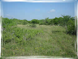
Topography is considered flat to less prominent as elevation increases inland. Mesquite is dominant in many sites throughout the region, regardless of other factors. Bottomland areas near creeks or rivers will often support larger hardwoods that are not found elsewhere in the region. As elevation increases and rainfall decreases away from the Gulf Coast, soil water content is often lower, supporting mainly species that are more drought tolerant.
Soils
Soils throughout this region are primarily sand-based. Mud flats near the Gulf Coast often have high salt content and only support vegetation such as salt grass. Mesquite can be found anywhere in the region, regardless of soil type or quality, whereas most large hardwoods are found primarily in the moist soils of creek and river bottomlands.
Vegetation Description
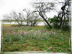
Vegetation is somewhat varied throughout the Western Gulf Coastal Plain region. Areas to the north and nearer to the Gulf Coast typically have slightly cooler summer temperatures and slightly warmer winter temperatures than do areas to the south and further inland. Live oak tends to be a major component of the region, especially north of the Nueces River and nearer the Gulf Coast. Other trees and shrubs common in the region include mesquite, huisache, Texas persimmon, bluewood, spiny hackberry, blackbrush, and ebony, among others. Larger hardwoods such as sugarberry, pecan, and gum bumelia are common in low-lying areas near rivers and creeks.
Impacts of Fire
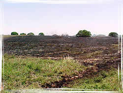
Fire has had minimal impact in this area in the past, because of agricultural practices. Additionally, damage caused by fire has been minimal because prescribed fire is used as a tool for range management for cattle operations and wildlife management. Controlled fires in open areas have benefited the area by clearing up surface fuels, allowing for better horizontal space among those fuels. Tree mortality after a wildfire is minimal because fires in this region are mostly wind-driven with rapid rates of spread. Grass/brush type vegetation mixed with live oaks and mesquite make up the predominant carrying fuels. The biggest impact of fire to this eco-region is not to natural resources; but, because of increased building in the Urban/Wildland Interface, fires have the capacity to have a devastating impact on residential homes and other such property in these former predominantly rural areas. In general, though, in the past, fire has had a positive impact to this eco-region because of normal weather conditions, agricultural practices, and range management techniques prominent in this area.
Other
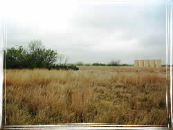
Agriculture is very prevalent in this region. Cash crops are primarily cotton, sorghum, wheat, and corn. Cattle grazing is also more economical in these areas than some of those farther to the west where rainfall is often much less. Quail and deer hunting are also of importance. There are several large ranches in the southern portion of this region where these practices are abundant.